Drone mapping a private tropical island
- Luke Wijnberg
- Dec 10, 2016
- 2 min read
3DroneMapping had the privilege of mapping a tiny private island in the Indian ocean off the Zanzibar coast in the Indian Ocean. This tiny (15ha) island is approximately 5NM from the mainland is is completely isolated from the rest of the world. Surrounded by live coral reefs and sand bars, the island is home to an exclusive, high-end resort. The resort prides itself in being completely self-reliant and offers guests individual service that would rival some of the best hotels. The island limits it number of guests to 20 to maintain the feeling of being remote and disconnected from the world.

Guests have private “bandas” or thatched bungalows that allow the gentle wind through the casuarina trees, while waves lap at the shore. Each meal is 3 courses, each planned carefully to suit guests needs and local availability. There is a butler per banda that does everything for guests from serving meals to putting out slippers . This is luxury and attention to detail that goes above and beyond any other resort.


The island resort prides itself in offering its guests privacy and high quality service. To maintain this feeling, the accommodation is spread out over the island in such a way so as to not intrude on adjoining structures or guests. Behind the scenes, and army of 65 staff on average also reside on the island. Besides accommodation, kitchens, storehouses, generators, saltwater desalination plants, boat sheds, and various other structures need to be hidden from guests.
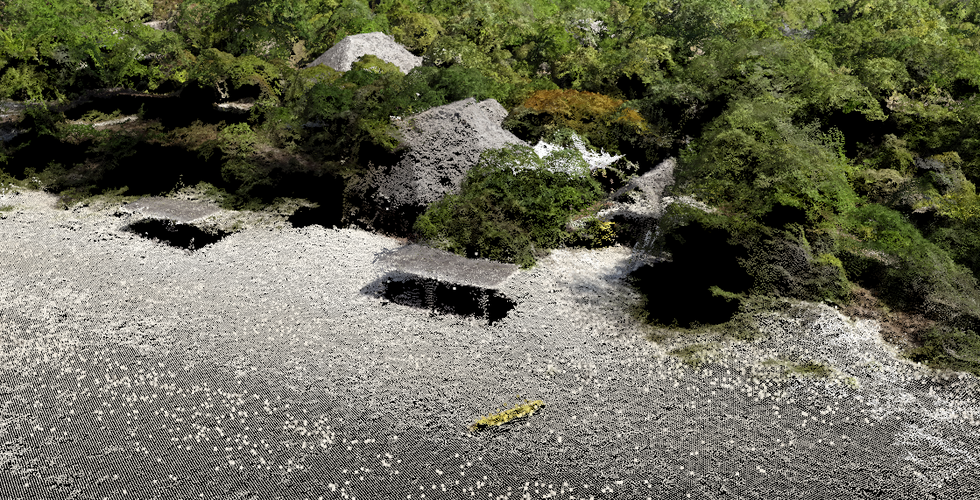
The main problem of shielding guests from the day to day operations is space. The island has limited space as it stands and is now in threat of it shrinking further. As currents have changed, part of the island is eroding at a very fast pace, So much so that the developers are concerned that some of the newly proposed structures will be washed out to sea in a few years. Since no plans or maps of the island have ever been drawn or surveyed, they felt it was important to give some scale and dimensions to the architects for the master plan.
The plan of the island was to include all existing structures, pathways, major trees, visible services, high tide marks, levels and contours. This needed to be done in a very tight timespan as the island closed for renovations in 3 months. Another major concern was that the survey could not disturb any guests while being carried out.


Using a multirotor drone with high resolution camera allowed us to operate high enough to still obtain images with good detail but far away enough from guests to not bother them. Total time for the flights was 30min, also reducing the time spent flying over paying residents. Control points were placed over the island at strategic places to not be visible to the public but in a fashion that met basic survey principles. These cost effective units have proved themselves over and over to be some of the cheapest and accurate single frequency receivers about and are perfectly suited to this type of survey.