Precision Drone Aerial Surveying: Safeguarding Mozambique’s Sugar Cane Fields Against Cyclones
- Charlie Wijnberg

- Feb 2
- 2 min read
At 3DroneMapping, we specialize in delivering high-accuracy geospatial data that supports critical infrastructure and agricultural resilience. Recently, we were engaged by Mariswe Engineers to conduct a comprehensive aerial survey of a 60 km storm-damaged dyke system at the Maragra Sugar Estate in Mozambique.
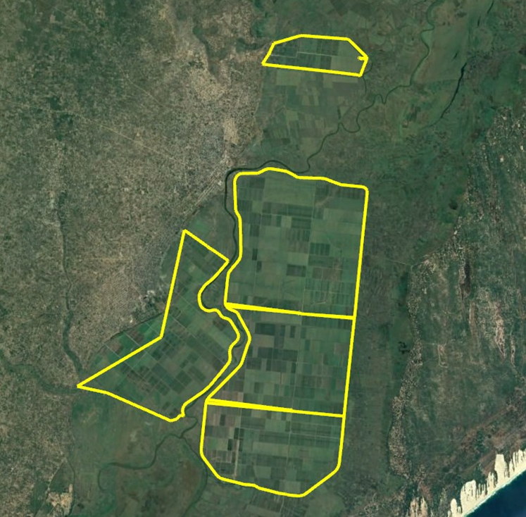
The recently reconstructed levees are essential for protecting extensive sugar cane fields from seasonal flooding and cyclones—events that pose significant risks to agricultural productivity and local communities in this flood-prone region. The client required detailed, reliable mapping to identify any construction deficiencies, assess structural integrity, and verify the system’s ability to withstand extreme weather.
Advanced Technology for Demanding Environments
To meet the stringent accuracy requirements, we deployed a sophisticated sensor suite including:
A calibrated 50-megapixel metric camera
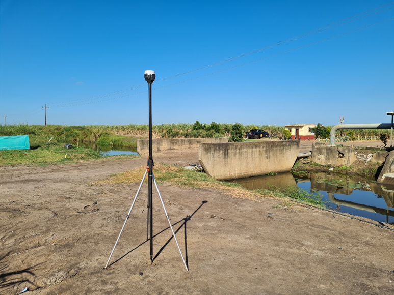
A high-performance inertial navigation system (INS) with dual-frequency GNSS
A Livox Avia LiDAR scanner operating at 720 kHz, capable of multiple-return pulses for vegetation penetration

This configuration enabled simultaneous photogrammetric and LiDAR data capture, ensuring exceptional detail even in areas of dense vegetation.
Precise flight planning maintained consistent 70% forward image overlap and terrain-following altitude adjustments, despite challenging conditions such as thermal turbulence caused by high ground reflectivity and heat. Post-flight trajectory processing—using tightly coupled GNSS-IMU PPK—achieved position deviations below 1.5 cm and angular accuracy better than 0.003°.
Overcoming Vegetation Challenges with LiDAR
Dense stands of sugar cane and reed beds presented significant obstacles to conventional photogrammetry. The LiDAR system proved invaluable, successfully classifying ground points beneath thick canopy where optical methods alone would have failed. This allowed for accurate digital terrain model (DTM) generation across the majority of the dyke network, with only limited interpolation required in the most heavily vegetated low-lying areas.
Ground control was established using dual-frequency RTK/PPK GNSS, with primary points coordinated to better than 10 mm and additional quality checkpoints for independent verification. Final vertical accuracies exceeded the target, achieving better than 3 cm (1-sigma).

Deliverables and Outcomes
The survey produced the following high-value products:
Orthomosaic imagery at 3 cm ground sample distance (GSD)
Dense point clouds with average densities of 30–50 points/m²
Classified and decimated DTMs in industry-standard formats
All data were delivered in WGS84 / UTM Zone 36S with EGM2008 orthometric heights, in formats including ECW (orthophotos), LAZ 1.4 (point clouds), and ASCII XYZ (DTM).
These outputs provided engineers with a precise baseline to evaluate levee performance, detect potential vulnerabilities, and inform reinforcement or maintenance decisions—directly contributing to improved flood protection and long-term agricultural sustainability.

Why 3DroneMapping?
Our experience in complex, vegetation-heavy environments demonstrates the real-world advantage of integrated LiDAR + photogrammetry workflows. When accuracy, penetration, and reliability are non-negotiable, 3DroneMapping delivers actionable geospatial intelligence.
Ready to discuss how advanced aerial surveying can support your next infrastructure or agricultural project? Contact our team for a consultation.


