
3DRONEMAPPING
Drone based LiDAR aerial surveys by 3DroneMapping
WHO WE ARE
3DroneMapping has been providing high-accuracy drone based LiDAR aerial surveys in Africa for the past 15 years. Our expertise lies in tackling challenging survey sites that are either too expansive for traditional drone systems or not cost-effective for manned aviation. By investing extensively in R&D and utilising advanced LiDAR technology, 3DroneMapping has developed proprietary long-range drones for achieving exceptional survey results.
SERVICES

LiDAR SURVEYS
Using a multiple return laser scanner, terrain is measured at a rate of over 720 000 times a second to produce a very dense pointcloud. The density of the pointcloud as well as small beam divergence allows laser pulses to penetrate small gaps in the vegetation cover to target and measure ground levels. This allows us to "see" inside vegetation cover and be able to accurately contour a bare earth terrain model after classification.
Our LiDAR units are capable of being deployed on a short range multirotor for very dense pointcloud mapping or on our large long range VTOL platforms for surveys up to 850km²
ORTHOMOSAIC
Using multiple stereo pairs, it is possible to generate orthophotos with true orthogonal projection. Compared to imagery captured by manned aircraft or satellite, orthophotos derived from a drone platforms tend to be clearer, more detailed and have a higher dynamic range. Since the camera is closer to the ground, detail in shade or shadows can be determined. This also allows for sharper images since less dust or pollution is "looked" through.


DIGITAL SURFACE &
TERRAIN MODELS
Generating Digital Surface and Terrain Models (DSM & DTM) from drone data can be quickly and accurately calculated via photogrammetric or LiDAR methods. Pointclouds can be classified into various categories that help distinguish terrain features. Ground levels are further refined by editing the DTM directly in a 3d environment and later decimated to reduce file sizes while retaining the accuracy and terrain features.
From DTM, contours, cross-sections and other data outputs can be calculated.
CLIENTS

FLEET
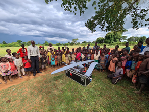
3DroneMapping's fleet is custom built for African conditions. These modifications have carefully been considered after years of research and development in actual field conditions. These are shipped from project to project and contain their own field maintenance equipment for any onsite repairs.
VTOL (Vertical Takeoff and Landing) fixed wing drones are typically used for larger areas (between 500ha and 80 000ha) while multirotor platforms are more suited for smaller surveys (<500ha).
All aircraft carry a LiDAR scanner and RGB imager as standard payload and are capable of high rate INS trajectory post-processing.


Previous Aerial Surveys
FAQ
CONTACT US


