Verifying the accuracy performance of the DJI L3 LiDAR scanner with the Emlid Reach RS4 Pro
- Charlie Wijnberg

- May 20
- 3 min read
Updated: Jun 15

3DroneMapping recently acquired the new DJI M400 drone and Zenmuse L3 LiDAR scanner. The L3 is a significant upgrade over the L2, offering much greater detection range (up to 950 m+ vs ~450 m), up to 16 returns (vs 5) for superior vegetation penetration, higher accuracy, and a higher pulse rate for denser point clouds. While the L3's capabilities are well documented, we wanted to verify the unit's end accuracy for ourselves — to test the implications of using a non-DJI GNSS base, and to determine whether PPK is superior to RTK for the final point clouds.
Test site and ground control
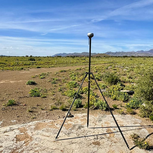
At our calibration site in South Africa, a network of ground control points (GCPs) was distributed over a 2 km area and measured with the Emlid Reach RS4 base and RS4 Pro GNSS rover. The Reach RS4 delivers reliable centimetre-level RTK performance — 7 mm + 1 ppm horizontal accuracy, fixed solutions in about 5 seconds, strong multipath resistance thanks to full-band (L1/L2/L5/L6) tracking, and excellent tilt compensation (RTK + 2 mm + 0.3 mm/°). In total, 8 control points and 25 independent check points were surveyed.


Flight and capture parameters
Using the Reach RS4 as a base, local NTRIP correction data was passed via the internal WiFi hotspot to the DJI RC Plus 2 Enterprise Enhanced controller, and on to the M400 to enable RTK positioning. This not only increased flight safety but allowed for precise geotagging of images and trajectory logging for the L3 scanner. The site was captured at 120 m AGL, at 350 kHz in a linear scan pattern with 30% sidelap. The Reach RS4 was simultaneously set to log raw GNSS data for later testing of the PPK workflow.


Processing: RTK vs PPK
Back in the office, the data was processed in the latest version of DJI Terra, the default software for processing the L3 dataset into usable raw formats. Using the limited options in Terra, the project was calculated twice: once with the RTK-only observations as the base for the trajectory POS file, and a second time with the PPK base observations. No smoothing or adjustments were allowed, and no ground control points were included to influence the results — so the two clouds could be compared on the raw trajectory solution alone.
Results
The point clouds were loaded into LiDAR360 and compared against the control and check measurements.
Before adjustment to control, the RTK-only observations gave more varying results than PPK. This is expected: PPK processes the full raw GNSS dataset after the fact (often with forward/backward smoothing), yielding higher accuracy, greater reliability in obstructed or long-baseline conditions, and no dependence on a real-time data link.
After adjustment to control, each dataset was tested against the 25 independent check points. The difference was larger than expected: PPK gave far superior results, with a much tighter distribution of Z values. At the check points, PPK reduced the vertical RMSE from 50.3 mm (RTK-only) to 9.6 mm — roughly a fivefold improvement — and tightened the spread of errors from a 177 mm range down to about 32 mm.
Vertical (Z) error at the 25 independent check points:
Z error vs check points (n = 25) | RTK-only | PPK |
Mean (mm) | +18.2 | −0.1 |
RMSE (mm) | 50.3 | 9.6 |
Standard deviation (mm) | 46.9 | 9.6 |
Max (mm) | +83.0 | +14.0 |
Min (mm) | −94.0 | −18.0 |
Vertical (Z) error at the 8 control points:
Z error vs control points (n = 8) | RTK-only | PPK |
Mean (mm) | +10.8 | +2.4 |
RMSE (mm) | 23.4 | 8.7 |
Standard deviation (mm) | 20.8 | 8.3 |
Max (mm) | +40.0 | +13.0 |
Min (mm) | −18.0 | −12.0 |
Even at the control points the PPK trajectory was markedly cleaner, but the gap widens at the independent check points — exactly where it matters for real-world survey accuracy.
Conclusions
Using a suitable base such as the Emlid Reach RS4 — with its modern multi-constellation capability and high-gain, low-noise antenna — gives far more accurate results than RTK alone. There are, however, a number of other factors that affect the L3's performance. Chief among them is the significant point-cloud noise present across all scan patterns and rates, and whether or not those points are retained or removed by Terra's default processing routines of strip alignment, smoothing and the like.
3DroneMapping provides high-accuracy LiDAR and aerial survey services across Africa. For enquiries regarding UAV LiDAR, aerial mapping, or equipment accuracy assessments, contact us at info@3dronemap.com.


