Testing the Emlid Reach RS4 Pro with BESSIE VTOL Drone for High Precision LiDAR Mapping
- Charlie Wijnberg

- Jan 19
- 3 min read
When it comes to drone surveys, accuracy and reliability in positioning data are critical. Recently, we had the opportunity to test the new Emlid Reach RS4 Pro base station paired with the Pilotless (3DroneMapping R&D) BESSIE VTOL drone. As longtime supporters of Emlid’s survey products, we were eager to see how the RS4 Pro would perform in real-world conditions, especially as a potential upgrade from the older Reach RS3 units.

Our test focused on a 30-hectare site equipped with 50 permanent ground control points. The BESSIE drone, with its 3.4-meter wingspan, was fitted with a MNM LiDAR system and a 102MP camera. We synchronized these sensors with an Emlid M2 PPK data recorder to capture precise positioning data for both LiDAR and photogrammetry workflows. Here’s what we found.
Why the Emlid Reach RS4 Pro Stands Out
The Reach RS4 Pro brings several improvements that make it a strong candidate for drone survey applications:
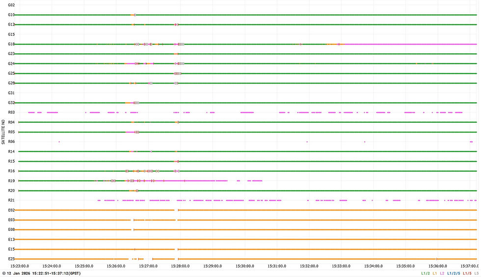
Updated GNSS chipset and antenna: This supports every GNSS constellation and signal frequency, including the newer L5 and L6 bands.
High satellite lock: The RS4 Pro can lock onto over 40 satellites simultaneously using 672 channels.
Resistance to multipath and interference: This is crucial for maintaining data quality in challenging environments.
Built-in long-range radio: Speeds up setting out ground control points in the field.
These features translate into better data quality and faster field operations, which are essential for surveyors and engineers working in remote or rural areas.


Field Testing with the BESSIE VTOL Drone
We chose the BESSIE VTOL drone for this test because of its versatility and payload capacity. The drone carried a MNM LiDAR system and a high-resolution camera, both synchronized with the Emlid M2 PPK data recorder. Although the M2 unit has not yet been updated to the latest chipset, the results were impressive.
During the flight over our 30-hectare test site, the LiDAR data showed an accuracy better than 25 millimeters when compared to the ground control points. The PPK processing consistently delivered 10-millimeter accuracy, even with interior-orientation limited bundle adjustments in photogrammetry. This level of precision is more than adequate for many engineering and surveying projects.
Benefits for Photogrammetry and LiDAR Workflows
Using the RS4 Pro in combination with the BESSIE drone and MNM LiDAR system offers several practical advantages:
Improved data quality: The RS4 Pro’s advanced GNSS capabilities ensure high-quality positioning data for both LiDAR and photogrammetry.
Faster setup: The built-in long-range radio reduces the time needed to establish ground control points.
Future-proof technology: Support for all GNSS constellations and frequencies means the system will remain relevant as satellite technology evolves.
Compact and portable: The RS4 Pro’s small form factor makes it easy to carry and deploy in remote locations.
These benefits make the RS4 Pro a valuable tool for surveyors working in challenging environments, such as rural Africa, where reliable and efficient fieldwork is essential.


Looking Ahead
The Emlid Reach RS4 Pro has proven itself as a reliable and precise base station for drone surveys involving LiDAR and photogrammetry. Its advanced GNSS technology and practical features make it a strong replacement for older units like the Reach RS3 or Reach RS2. With consistent sub-25mm accuracy in LiDAR data and 10mm PPK results, it meets the demands of professional surveyors and engineers.
For those working in remote or rural areas, the RS4 Pro’s portability, long battery life, and robust satellite reception make it a dependable choice. We plan to continue integrating this technology into our workflows and recommend it to others looking to improve their drone survey accuracy and efficiency.


